

Ijraset Journal For Research in Applied Science and Engineering Technology
Case Study of Mahad Flood
Authors: Siddhi S. Ghogare, Sudarshan B. Ghangale, Prachi S. Borhade, Abhijit V. Dawkhar
DOI Link: https://doi.org/10.22214/ijraset.2022.42080
Certificate: View Certificate
Abstract
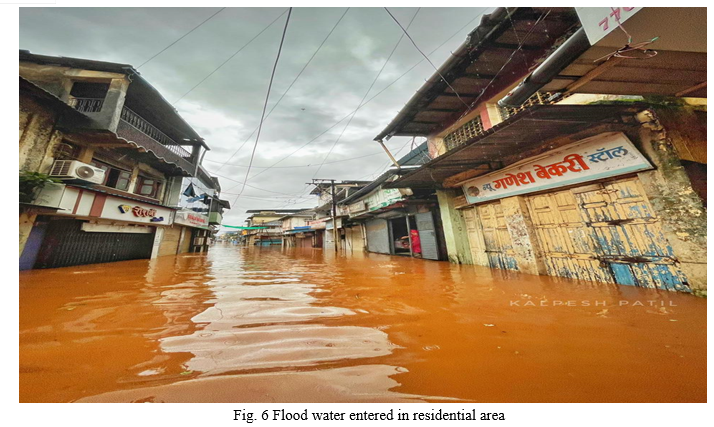
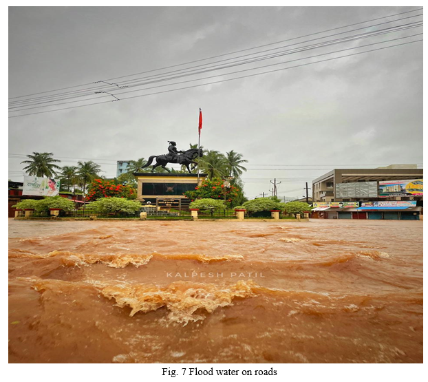
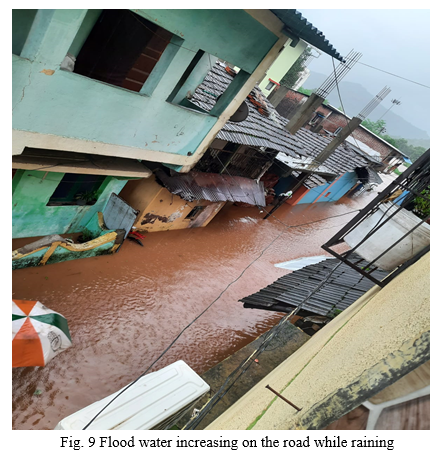
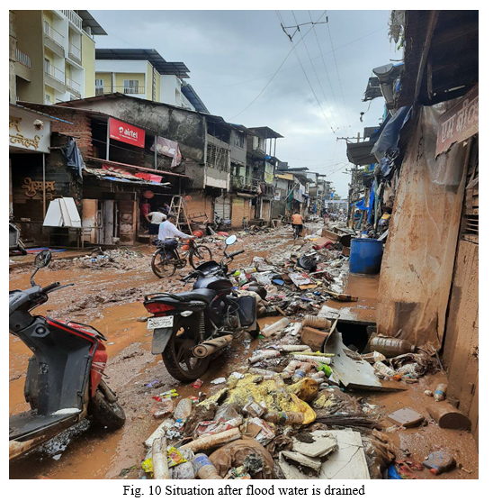
The case study deals with their solution of the problem of managing flood risk with the aim of effective management focusing on reducing flood risks and thus increasing the measure of flood Protection. Maharashtra’s Konkan region and several other western parts—especially, Raigad, Kolhapur and Sangali districts—are flooded every monsoon for the last five years. The inhabitants of this region live in constant fear of floods, which destroy lives and businesses. In this case of flood occurred in Mahad, we are going to study about what causes flood? & what are the measure actions we can take to control the flood or to manage the flood.
Introduction
I. INTRODUCTION
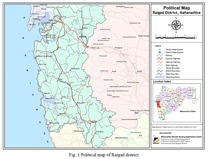
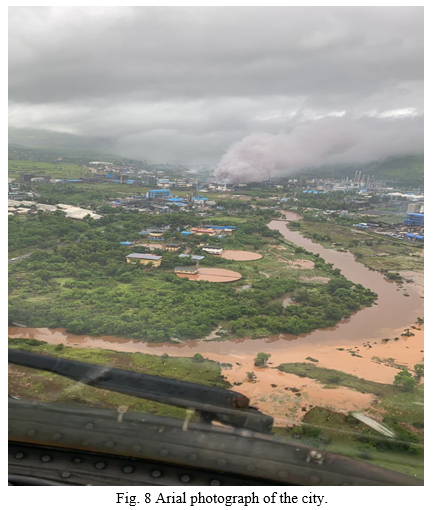
Mahad city is located 125km from Mumbai-konkan-Goa NH-17 in Raigad district situated north Konkan region of Maharashtra, India. It has total area of around 12km2. Previously was a port. Mahad is surrounded by Sahyadri mountains at the confluence of two rivers, Gandhari and Savitri, these rivers has watershed area around 119.14km2 and 700km2 respectively. Up to Mahad city, this rivers meets the major tributaries of Kal and Nageshwari. Since, the source of origin of all these rivers is close to Mahad, it takes very little time for flood water to reach the city. It has tropical climate and experiences extremely heavy rainfall during monsoon. Mahad averages with an annual rainfall of above 4,000mm. The G.L of city is 8.52m.
II. AIM AND OBJECTIVES
A. To study flood events in Mahad city.
B. To study causes of floods in Mahad city.
C. To suggest some solutions to manage or control the flood.
D. To study the factors affecting the development of Mahad city.
III. FLOOD HISTORY OF MAHAD
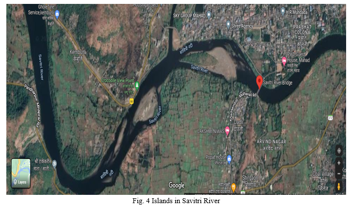
If we look at the history till today, the Mahad city is hit by floods every year. Out of these, high floods have been recorded in the years 1923, 1989, 1994, 2005, 2019 and 2021. In the year 1994, A committee was set up under the chairmanship of Shri. M. D. Pendse Secretary (CADA). The committee had made one of the recommendations for flood control regarding removal of islands formed in Savitri and Gandhari rivers. Then in 2005, 2019 and 2021, Savitri river floods have occurred again. There are 11 rain gauge stations on the Savitri river basin and four rain gauge stations on Gandhari river Basin in the year 1994 day before flood and on the day of flood there are both measurement of rainfall on the stations was more than the year 1989 in the year 1989 flood duration was about 15 hours that is on 23/7/1989 11:00 p.m. to 22/7/1989 2:00 p.m. On the date 24/7/1989 there was a high tide at 4:30 p.m. As soon as flood water increase high tide started during that period in the year 1994 flood duration was of 33 hours on the date 27/6/1994 8:00 a.m. to 28/6/1994 5:00 p.m. On the date 27/ 6 /1994 at low tide flood water level was started increasing and on 28/6/1994 evening at high tide flood water level started decreasing therefore 1994 flood was more effective than in the year 1989. In the year 1994 as on the stations rainfall measurement was more than that of the year 1989.
IV. ISSUES IN THE CITY
A. Tidal effect of the sea on the City
B. Urbanization, unplanned and rapid settlement development
C. Uncontrolled constructions of buildings in general and major land use changes.
D. Islands in the rivers Confluence of the Savitri and Gandhari river
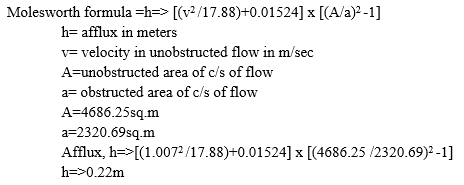
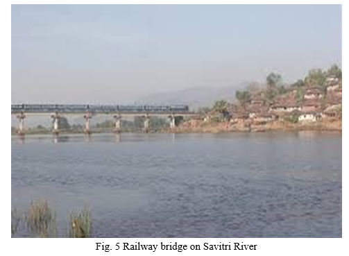
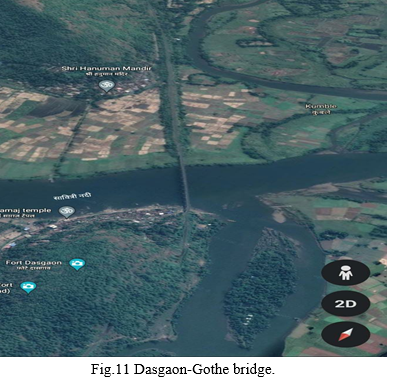
E. Dasgaon- Gothe Railway Bridge, below Bridge at a distance of 150m there is a meeting of Kal and Nageshwari river.
F. Afflux form due to this Bridge which is the about 0.22m.
G. Extremely heavy rainfall.
V. STUDY AREA
A. Savitri River’s simplification
B. Arabian Sea’s tidal effect
C. 25 to 100 years prediction
D. Determine the slopes and height of the protection walls
E. Extension of the water ways
VI. METHODOLOGY
A. Dasgaon-Gothe railway bridge
During the construction of this bridge workers had filled the riverbed, river became narrow and the water level of the river got increased which lead to the overflow of the rivers and affected the drainage system to some extent.
The afflux formed due to bridge was about 0.22m
This afflux is calculated as per the Molesworth Formula
B. Development
Large amount of fillings in the hollow areas near river bank for the construction of new buildings and rapid development of the city also resulted on the drainage system of the city.
C. Dams
Dams constructed like Koturde, Warandh, Kusgaon, etc. are not large storage capacity dams.
D. Soil erosion
Soil erosion is also the one of the reason foe increase in the water level of the river.
E. Confluence of rivers
The confluence of Savitri and Gandhari river near the Mahad, islands in these river, meetings of Kal and Nageshwari rivers to Savitri river below bridge around 150m distance, floods in these rivers and meanwhile high tide effect of the sea are the complex reasons for the flood in Mahad.
VII. MEASURES
A. Structural Measures
Flood management is often done to prove peak flow formation and to reduce the extreme discharge. The following conventional structural measures are considered, depending upon the flood peak and degree of defence provided.
- Flood control dams and retention dikes, to protect urban property and productive agriculture lands.
- Flood control gates, to prevent the back-up of high flood waters.
- Widening and deepening of river bed, tributaries and natural drains.
- Diversion channels and retention ponds, to divert floods to pre-designed wetland areas, where habitation and agricultural activities are avoided.
- Mobile deflectors, for protection of rural infrastructures.
- Reservoir storage or flood-basins, as water retention for dry season irrigation.
B. Non structural
- The introduction of advanced hydro-dynamic simulation techniques for early warning and flood forecasts.
- An improved system of collection and dissemination of water level information and reinforcement of hydro-meteorological network, to improve the flood forecasting information.
- Use of satellite flood imagery, differential Global Positioning System (GPS), topographic mapping and spatial database for possible analysis of flood prone-areas and sufficient accuracy for inundation forecasting.
- Regional approach to the planning and design support and further institutional strengthening by setting up independent river basin authorities.
- Capacity building of current staff in irrigation, water resources and municipal authorities.
- The formation of state disaster management plan and flood policy for each urban centre for flood relief, local preparedness and actions in flood mitigation.
- Relocation of buildings, from the flood plain areas, as per the extreme value analysis.
- The non-structural methods for mitigation of flood hazards are very cost effective compared to structural ones (dams and dikes) [10]. Japan has developed an advance flood warning system, which allows the smooth evacuation of residents and to promote an awareness of flood prevention. Therefore, the non-structural measures are adopted in mitigation of flood disaster. A good way to prevent/reduce damages occurred from flood is, to develop a Flood Forecasting and Warning System (FFWS) in the affected area. All in all, integrating structural and non structural measures can be a very power full tool, to minimize effect of flood in and around Mahad city.
C. Flood forecasting system
The existing CWC flood forecasting system seems inadequate for current period because the agency is having limited information in terms of rainfall record, not enough inflow data and absence of recent techniques useful for river monitoring and forecasting system as modern technology is developed day by day. However, rapid population growth in the region, intensification of agriculture, climate change, changes in land use and river morphology and rapid technology development, it is essential to upgrade the conventional forecasting system. Using latest technology the informative and effective warning system should be installed. Improvement in flood forecasting operations requires continuous efforts in many fields including river monitoring network. For that, the automatic rain gauge stations should be established, which records hourly data accurately and transmitted it to the data centre. Hourly data gives precise results than the daily data.
Development of advanced forecasting techniques, communication network and assessment of forecasts can be done by data collection, transmission and processing. To improve the river monitoring network, data collection and transmission system and the hydro-meteorological network is in the process of being rehabilitated and upgraded to provide more timely and accurate data.
To establish new flood forecasting system we require
- Adequate rainfall and runoff record, river gauging and discharge measurement stations at several locations.
- Proper method, for finding out safe carrying capacity of river at various sections along the river.
- To find the probable submerge area.
VIII. RESULT ANALYSIS
Conclusion
1) Accordingly, there is an urgent need to complete the construction of further dams in the Mahad river basin. a) Kal Hydroelectric Project 95.00 Mcum. b) Kotheri Minor Project 8.80 Mcum c) Kalwali Dharwali Minor Project 6.40 Mcum d) Nageshwari Minor Project 20.70 Mcum. Total - 130.90 Mcum 2) Bhave Bruhut Minor Irrigation Project (Capacity 42.69×10⁶ m3) is proposed on the tributary of Savitri River above Mahad city and no action has been taken on this project. 3) The sites available under construction at Kalavali Dharwali, Kotheri and Nageshwari have high drainage capacity with 50 per cent reliability. However, low capacity dams have been constructed at this dam site due to low availability of catchment area. 4) Sufficient and reliable data are much needed to achieve higher degree of accuracy, which can be achieved by establishing new automatic recorded river gauge station. 5) To survive the Mahad city from flood, advanced flood forecasting/warning system should be established as early as possible. All the existing and proposed river gauging stations should be connected through satellite and after proper analysis of data, available information should be transferred to the dam authority. Considering D/S carrying capacity of the channel, authority will take decision to release discharge. 6) Learning lessons from the past flood events. Modifications are necessary in the rule curve for the operation of dam. 7) Need to construct Gabion dam on the catchment areas so that river carrying silt will be reduced. 8) Tree planation should be done to control soil erosion as well as terracing the mountains.
References
[1] Govt. of Maharashtra, 2021. Maharashtra State Irrigation Department Report. 2021. [2] National Water Policy of India,1987 [3] INCID, Non-structural aspects of Flood management in India, Abridged version. [4] Govt. of Maharashtra, 2021. Raigad dam projects. [5] Tanoue, S., Japan’s Flood Warning System. River Bureau, Ministry of Land, Infrastructure and Transport, 2-1-3 Kasumigaseki, Chiyodaku,Tokyo, Japan, 2003, pp. 85-97.
Copyright
Copyright © 2022 Siddhi S. Ghogare, Sudarshan B. Ghangale, Prachi S. Borhade, Abhijit V. Dawkhar. This is an open access article distributed under the Creative Commons Attribution License, which permits unrestricted use, distribution, and reproduction in any medium, provided the original work is properly cited.

Download Paper
Paper Id : IJRASET42080
Publish Date : 2022-04-30
ISSN : 2321-9653
Publisher Name : IJRASET
DOI Link : Click Here
 Submit Paper Online